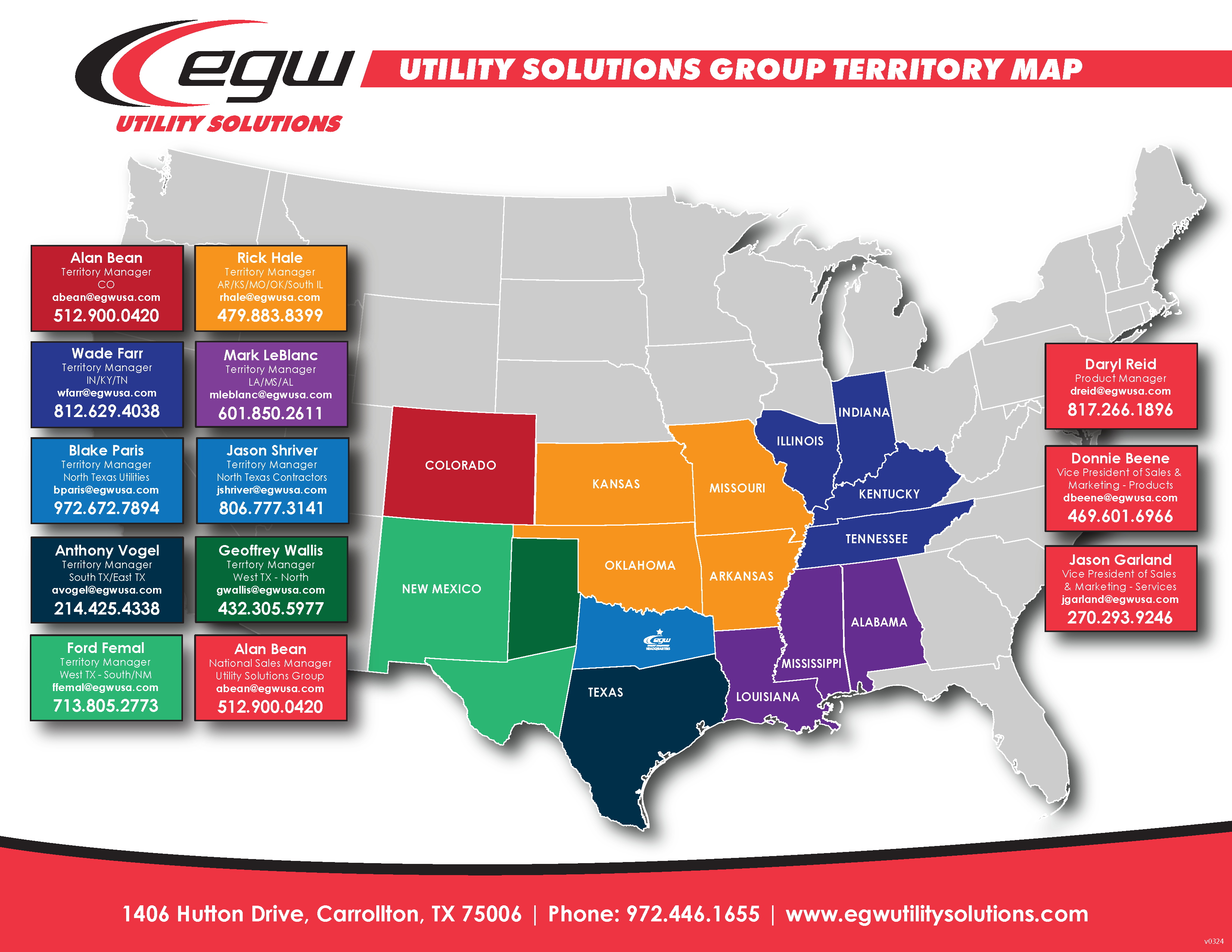
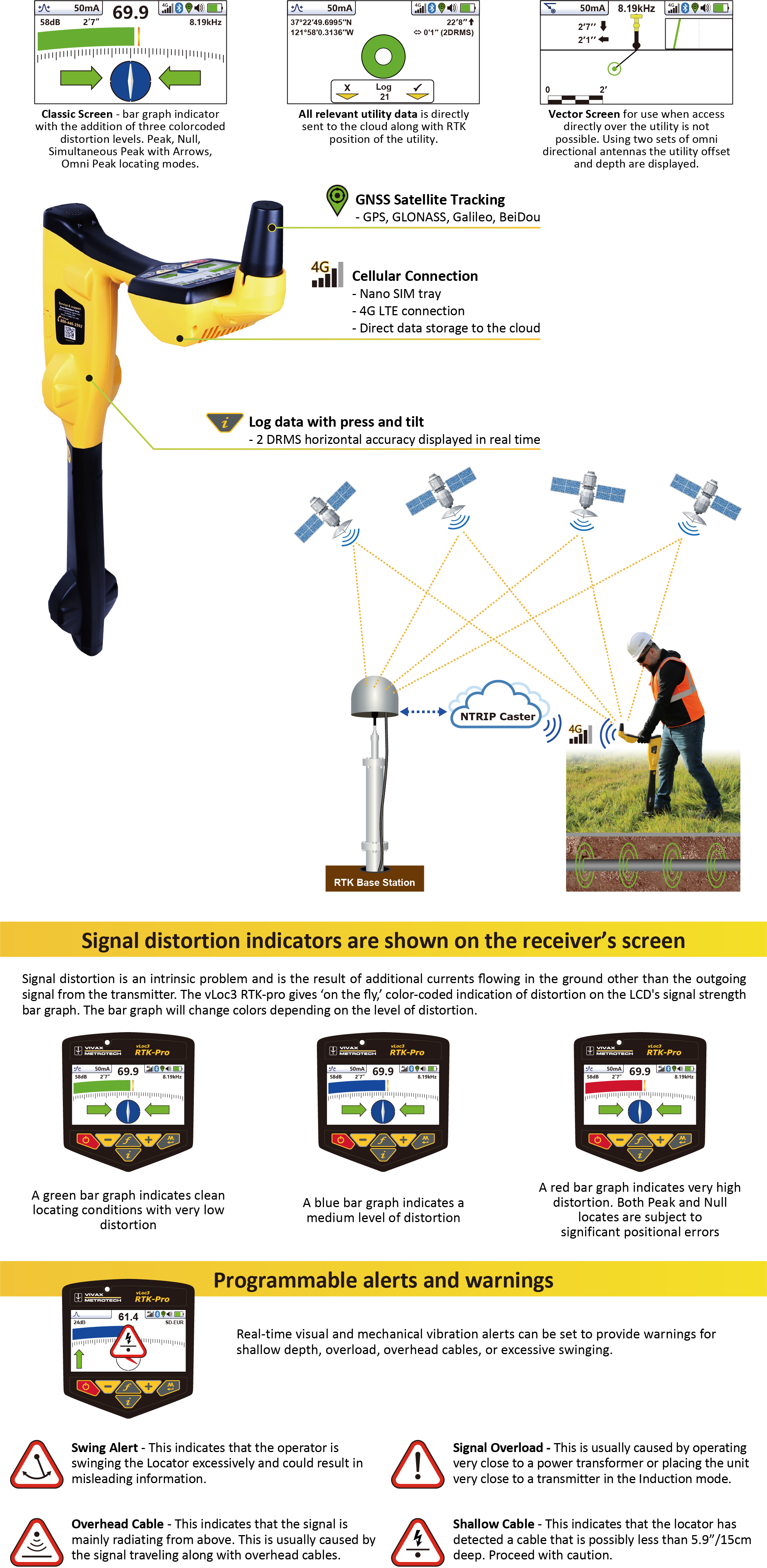
Reduct Pipeline Mapping
3D Gyroscopic Pipeline Mapping Technology
Underground space for utilities and other assets is rapidly becoming a scarce commodity. As the number of installations and excavations increases, so does the risk of damage to existing infrastructure. Obtaining accurate geospatial data of existing and new subsurface utilities is no longer a ‘nice to have’, it is rapidly becoming a ‘must have’ to minimize damage risk, thus optimizing uninterrupted service delivery to your customers.
But Reduct’s mapping solutions provide more than just XYZ data for your GIS platform. The high-frequency logging rate enables accurate measurement of the bend radius or inclination along a segment of a pipe or duct. Although often specified, bend radius and inclination are virtually impossible to measure accurately other than with a high frequency gyro mapping system.
Don’t take the risk, get it mapped.
Contact your EGW Territory Manager or fill out the form below to request more information!
Reduct Sector Brochures
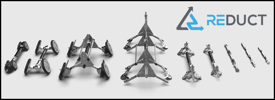
Reduct Pipeline Mapping Equipment
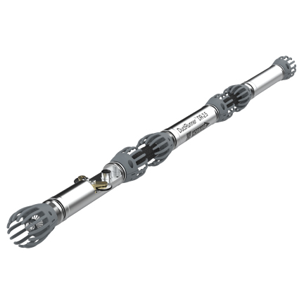
Reduct ABM-90/DR-4 with Centralizers
Covers the largest pipe ID range thanks to exchangeable centralizers
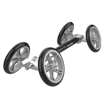
Reduct ABM-90/DR-4 with Invert Wheel Sets
When lateral connections or poor interior condition force you to “stay low”
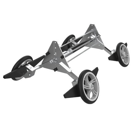
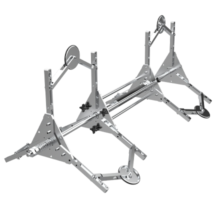
Reduct ABM-90/DR-4 with IW-1000+ Frame
When lateral connections or poor interior condition in very large diameters force you to “stay low”